Posts

Showing posts with the label design principles

Bicycle Transportation Supporting a Strong Towns Approach
Image
This final post for my blog will briefly talk about why I chose the topic of bicycle transportation and how it transforms urban landscapes and communities through a Strong Towns approach. I will also suggest why people in the United States should care about this topic. Simply put, I chose this topic for my final project because, in my four weeks in these two countries, there really was not one isolated thing I could direct my attention towards. I mean, there were plenty of options, but each topic drove outcomes or was an outcome, of another tangible element of the system. It is difficult to talk about the effectiveness of cycle tracks and enhanced safety without quickly pivoting to the reclamation of space, which then introduces discussions about increased development of housing, commercial businesses, public space, which then . . . the list just goes on like that. All of those topics could direct our attention to the city's financial health; the total number of amenities and asset...

Biking and the Effect on Land Use

Image
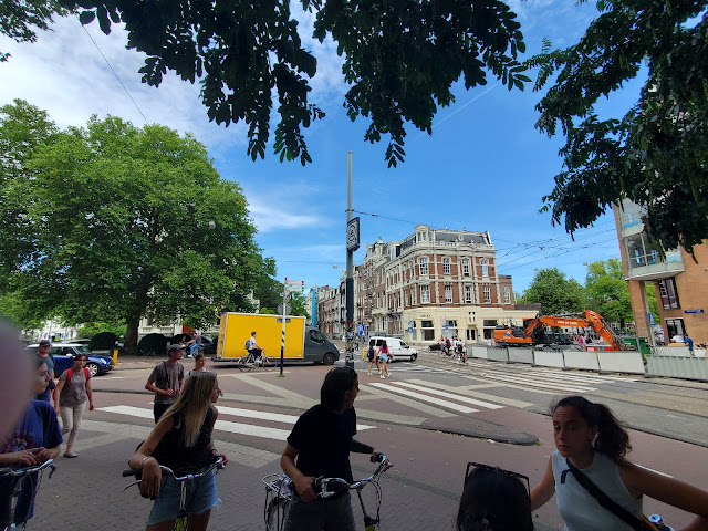
Focusing on examples seen in both Utrecht and Amsterdam, another takeaway of this trip is the land use patterns I have witnessed visiting these cities. What drew my eye throughout exploring the different places is the availability of space that allows one to feel safe traveling via any mode. While our group notably saw fewer segregated spaces between modes in the Netherland examples compared to Denmark, that does not mean they did not exist. In the image below, an intersection in Amsterdam about a five-minute walk east of our hostel, one can see how crossings provide a lane for bikes and pedestrians to travel, keeping them separated from car, bus, or tram traffic. The islands between the crossings keep pedestrians safe when waiting for cross-traffic to clear the pathway but the islands also narrow the vehicle lanes, slowing traffic through the intersection and thereby enhancing safety. Presented in the picture are bicyclists crossing the road in the bike lane, with oncoming cars moving...

Not So Different from Us

Image
This post responds to a prompt where I will write as if I am describing what I've seen in the Netherlands to a family member who is likely to reply that the Netherlands is far different from the United States and that what works here would not work in the U.S. Fun fact: did you know the Dutch also complain when anyone talks about taking a parking spot away? It's true! During the tour of the Dutch city Nijmegen, our guide, Sjors, mentioned that in creating much of the bicycling network we witnessed and biked along, pushback over parking existed and presented a barrier to the city council in supporting projects that would increase the bicycling infrastructure around the area. In describing one presentation about increasing bicycling infrastructure he gave to government officials, Sjors mentioned spending the first 10 to 15 minutes talking exclusively about cars. This aspect impressed upon me how many Dutch think about their cars and ease of driving, which is not so different comp...

Biking through a University Town (Odense)

Image
Our last stop in Denmark brought us to the country's third most populous city, Odense (estimated population in 2022 of approximately 172,500 residents). The population and size of the city provided an apt comparison to the city I've lived in the past two years, Eugene, Oregon. Not only are the populations comparable, but we learned that Odense is considered a "college town", supported by three universities: the School of Social Work under the umbrella of the University College, Little Belt network, Odense University, and the largest of the three, Southern Denmark University (SDU). The universities' presence is comparable to Eugene, which is home to Bushnell University, Lane Community College, New Hope Christian College, and the flagship institution, the University of Oregon. The task at hand then is to experience what it is like biking in a city that is predominantly younger, bolstered by the student population, but also one that is over 1,000 years old. I must ad...

Biking On Route 55 to Odense

Image
The journey from Korinth to Odense felt like a regional, long-distance commute, and for the first time, I experienced the potential of what regional bicycle transportation can provide between communities. As mentioned in a previous post about recreational cycling in Denmark, I began the journey from Korinth taking a recreational bike trail route labeled L1. End to end, the route took about 8 kilometers (approximately 5 miles), delivering me to the town of Ringe. From Ringe, I biked through the town on my way to Bike Route 55, which would take me all the way to Odense. Along my ride through Ringe, I recognized several of the traffic calming designs where pedestrians can cross the road and also deliver bicyclists through the intersection (see image below).   After taking a few back roads while traveling through Ringe, a narrow bicycle lane delivered me to Bike Route 55. The distance from Ringe to Odense is approximately 23 kilometers (a little over 14 miles). For the past three days,...

Recreational Cycling in the Danish Countryside (Aero Island, Korinth, and Rail Trails)

Image
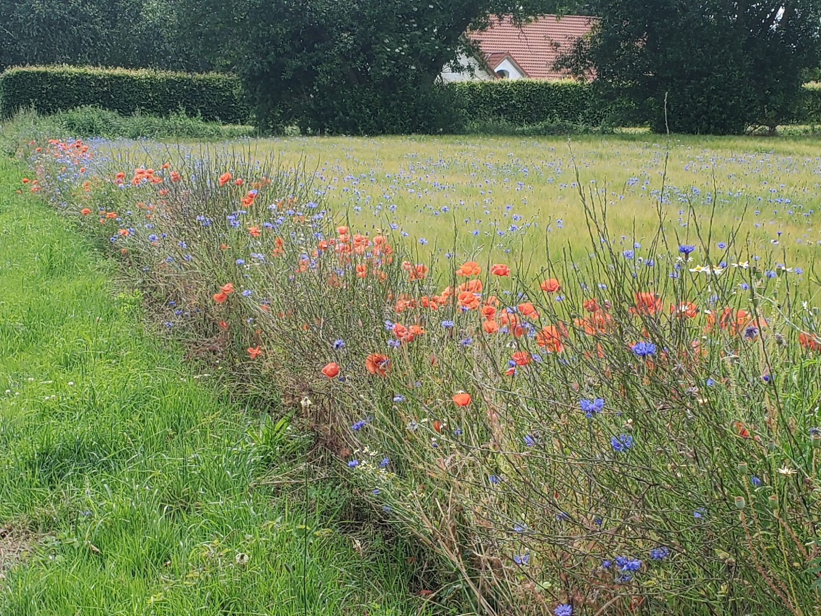
Following Copenhagen, the second leg of the four weeks abroad took our group to three smaller communities: Svendborg, Aero Island, and Korinth. We focused our activities on the recreational and tourism component of Denmark’s National Bicycle Strategy (henceforth in this post referenced as “The Strategy”). Six characteristics encompass what the Strategy determines as elements of effective recreational cycle routes: safety and security, tourism, service, comfort, signage, and meaningfulness. I noted aspects of each of these elements during the three days spent in these Danish communities, albeit in varying combinations and relationships to one another. Wildflowers along the bike route on Aero Island Notable during our day trip to Aero Island were aspects of signage, tourism, and for about half the trip, comfort. I will qualify “about half the trip” by noting I personally do not have much experience biking on gravel paths or traversing up and down steeper inclines as I experienced during ...

Touring Copenhagen with Copenhagenize

Image
On our last day in Copenhagen, the group visited a local urban planning and design firm, Copenhagenize. The presenter and tour guide, James, originally came from Toronto but mentioned living in Stockholm and Copenhagen over the past decade. His presentation reviewed some of the concepts we had already learned both from other lectures and bike tours, such as the infrastructure types that I had seen throughout the city (i.e., cycle tracks and the curb ramps that help one enter bicycle lanes). However, I appreciated the extended level of detail provided about the typology of infrastructures. For example, the group learned how the infrastructure aligned with the relationship between speed limits for cars and where the bicycle lanes existed. When cars traveled at the slowest speed, about 10 mph, the road is most often shared between cars and bikes, with no discerning infrastructure for bicyclists. At driving speeds of 20 mph, one sees bicycle lanes painted on the road with no physical barri...