Posts

Showing posts from June, 2022

Recreational Cycling in the Danish Countryside (Aero Island, Korinth, and Rail Trails)

Image
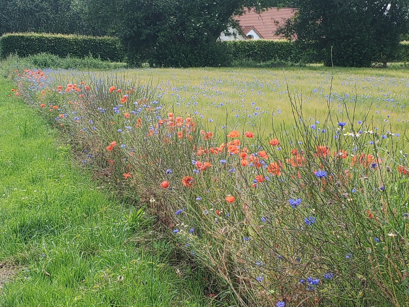
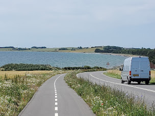
Following Copenhagen, the second leg of the four weeks abroad took our group to three smaller communities: Svendborg, Aero Island, and Korinth. We focused our activities on the recreational and tourism component of Denmark’s National Bicycle Strategy (henceforth in this post referenced as “The Strategy”). Six characteristics encompass what the Strategy determines as elements of effective recreational cycle routes: safety and security, tourism, service, comfort, signage, and meaningfulness. I noted aspects of each of these elements during the three days spent in these Danish communities, albeit in varying combinations and relationships to one another. Wildflowers along the bike route on Aero Island Notable during our day trip to Aero Island were aspects of signage, tourism, and for about half the trip, comfort. I will qualify “about half the trip” by noting I personally do not have much experience biking on gravel paths or traversing up and down steeper inclines as I experienced during

Biking on Aero Island: Recreational Biking

Image
Today, the group traveled to Aero Island. The task at hand: to complete an approximately 27 miles biking route around most of the island. The terrain varied from paved roads to gravel roads and included a brief stretch of dedicated bicycle lanes where the cars can travel at approximately 35 to 40 miles per hour. The trip felt like a recreational, cycling enthusiast ride, it allowed me to notice differences in biking infrastructure between a smaller community and what I observed while spending time in Copenhagen. A bicycle highway lane running alongside a road on Aero Island View from the ferry of a small Danish town First and most notably is the shared space between bicyclists and automobiles. I saw narrow bike lanes painted on the roads closest to the harbor district area where our ferry dropped us off. However, on most of the island, dedicated bike lanes were absent, and cars shared the road with bicyclists. This included both paved roads and gravel roads in the more remote areas of

Touring Copenhagen with Copenhagenize

Image
On our last day in Copenhagen, the group visited a local urban planning and design firm, Copenhagenize. The presenter and tour guide, James, originally came from Toronto but mentioned living in Stockholm and Copenhagen over the past decade. His presentation reviewed some of the concepts we had already learned both from other lectures and bike tours, such as the infrastructure types that I had seen throughout the city (i.e., cycle tracks and the curb ramps that help one enter bicycle lanes). However, I appreciated the extended level of detail provided about the typology of infrastructures. For example, the group learned how the infrastructure aligned with the relationship between speed limits for cars and where the bicycle lanes existed. When cars traveled at the slowest speed, about 10 mph, the road is most often shared between cars and bikes, with no discerning infrastructure for bicyclists. At driving speeds of 20 mph, one sees bicycle lanes painted on the road with no physical barri

Infrastructure Scavenger Hunt (Copenhagen)

Image
On the last day in Copenhagen, we were tasked with another scavenger hunt. This time, we searched for particular types of bicycle supportive infrastructure. The most visible examples include the curb assists that allow bicyclists to transition from the road into a cycle track. And of course, the cycle track itself. A protected cycle track in Copenhagen Elements of many intersections in Copenhagen include designating where the bicycle lane continues after the cycle track transitions into the intersection. Naturally, the road must remain accessible for cars to travel through, so the cycle track segment must end when one enters an intersection. So, blue paint identifies for both bicyclists and drivers where the bike lane continues through the intersection, giving bicyclists certainty in where to be and drivers certainty of where the biking traffic will be, especially those making a left or right turn through the intersection. As I noted from the previous blog post, earlier in the day duri

Biking as Play: Copenhagen's Playgrounds

Image
Today, our group visited one of Copenhagen’s playgrounds. The site included typical elements of any playground­-swings, slides, climbing structures-yet the main attraction of our visit was the traffic playground. The playground design teaches young children how to bike, not only the physical skill of biking but also the traffic culture associated with biking in the city. Not long into our tour of the playground, I could not help but think, “This makes entirely too much sense to me.” The simulated environment allows children to learn how to navigate lanes, turn their bikes at intersections, stop at traffic lights, and know when it is time to go through the intersection, similar to how adolescents in the United States learn to drive a car. However, that the course is so well designed for young children, even toddlers (the instructor mentioned children start learning to ride a balance bike as early as two or three years old) really promotes an early adoption of biking as a transport mode,

Biking Tour of Copenhagen

Image
One of our first activities around the city was taking a bike tour. A Danish individual known as Bike Mike led us along a winding tour through numerous neighborhoods, from the old city center to the harbor district, and even into the royal plaza, pointing out the four residences of the Danish Royal family. Pointing to the flag at the top of one building, we learned the princess was in residence at the time. Residence of Mary, Crown Princess of Denmark It was interesting to see the comfort and casualness with which our tour guide weaved through space, not often hand signaling but letting us know at the front, “we’re going left” or “we’ll head down that way”. If nothing else, it allowed me an opportunity to practice my own hand signaling while trying to keep up with our guide. On the first day I arrived, I biked around the city on my own and this tour presented a different experience of biking in a large group. I imagine we were a tad disruptive to the automotive drivers and other bicycl

Arriving in Copenhagen

I enrolled in this study abroad course to experience how biking for transport can work when provided with supportive infrastructure. Moreso though is to understand how culture translates into the political will required to advance projects that make design concepts into reality. The United States remains an automobile-dominated transportation system. Traffic plagues nearly all major cities and metropolitan areas. The consequences of lost time spent in traffic, the personal effects of sedentary lifestyles and externalities such as social exclusion, and the environmental impact of gasoline use and emissions are well understood. The predominant response to the consequences of an automobile-dominated system is “green” the vehicle fleet. Essentially, “how can we keep what we have, but not pollute the environment at the same time”? Nevertheless, such solutions do not address the disparities in car ownership between different populations. For example, electric vehicles are more expensive comp