Recreational Cycling in the Danish Countryside (Aero Island, Korinth, and Rail Trails)
Following Copenhagen, the second leg of the four weeks abroad took our group to three smaller communities: Svendborg, Aero Island, and Korinth. We focused our activities on the recreational and tourism component of Denmark’s National Bicycle Strategy (henceforth in this post referenced as “The Strategy”). Six characteristics encompass what the Strategy determines as elements of effective recreational cycle routes: safety and security, tourism, service, comfort, signage, and meaningfulness. I noted aspects of each of these elements during the three days spent in these Danish communities, albeit in varying combinations and relationships to one another.
 |
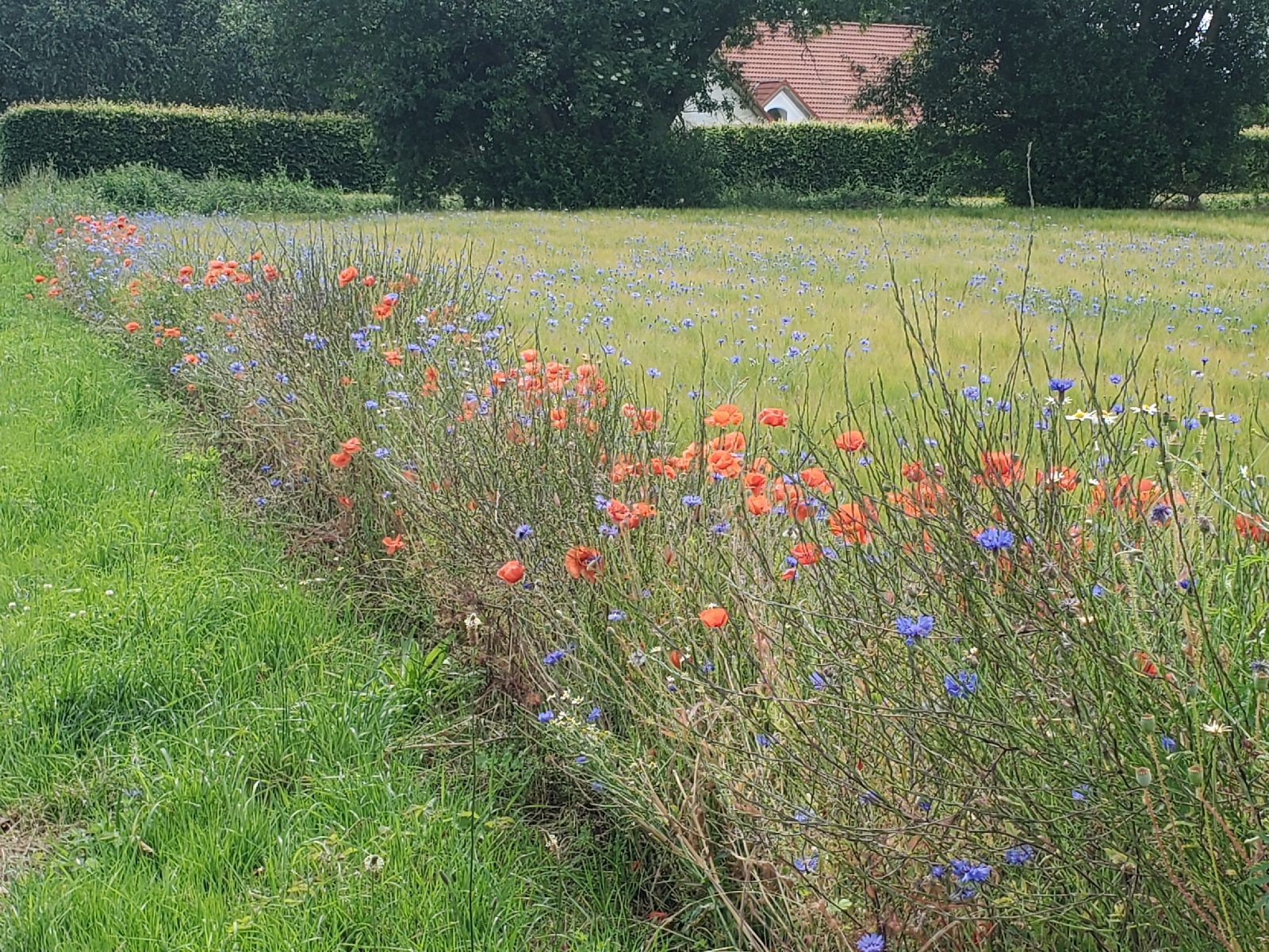
| Wildflowers along the bike route on Aero Island |
Notable during our day trip to Aero Island were aspects of signage,
tourism, and for about half the trip, comfort. I will qualify “about half the
trip” by noting I personally do not have much experience biking on gravel paths
or traversing up and down steeper inclines as I experienced during the nearly
thirty-mile route our group followed. Through the first third of the ride, I
felt comfortable biking on paved roads through the small towns of Aeroskobing
and Marstal (where I stopped for an early lunch). The segment of the route
afforded a flat and smooth ride and here I noted the most visible examples of
signage directing cyclists through the residential areas along the national
bike route. Between the towns, one finds a bucolic environment, where wildflowers
and billowing grasses dot the landscape. Now and then, I passed cows and
sheep grazing on the short grasses.
When describing comfort, The Strategy notes, “A change
of route layout should not cause reduced comfort, for example by introducing
more climbs, conversion from paved road to gravel or dirt roads
[emphasis added], or a greater number of 90 degree turns, unless it is dictated
by considerations regarding possibilities for experiences, services, or
improvements of safety (e.g., the disadvantages of hills may be offset by
the attractiveness of the venue [emphasis added])” (Denmark National
Bicycle Strategy, p. 46). Riding at a leisurely pace through the countryside
felt emblematic of that “offset” of experiencing the countryside compared to
the difficulties posed by the transitions between paved and gravel roads.
On the following day, our group biked through the mainland countryside from Svendborg to the small community of Korinth (an estimated 2022 population of 985). Terracotta-painted bicycle lanes supported the first several miles as we exited Svendborg and proceeded into the countryside. Once more, the group followed a predetermined route that did not exactly adhere to the national bike route, though the route more closely followed, and here I noted the importance of the signage element prescribed by The Strategy. Not only did the blue-painted signs support my directional awareness, but there were signs positioned throughout the journey pointing out the direction of towns between our starting and ending points that functioned well with the “entry” and “exit” signage as we passed over the municipal borders.
 |
| A brief stop in a Danish town, finding a church that functions as both a graveyard and public space |
For the most part, though, the further out into the country
we biked, the less supported biking infrastructure I observed. This fact
directly influenced my perception of safety and security. On the wider,
less busy roads, most cars reacted accommodatingly to our presence, slowing
down when devoid of a passing opportunity, then veering to the left to give us
space when accelerating to pass. I found myself relying significantly on my left
mirror to peer back and spot an upcoming vehicle when the sound of the car
reached within an earshot. In this sense, the selection of the biking route for
most of the journey provided an element of safety for us that was also
contingent on the behavior of both of us cyclists and motorists. However, we
then took a path alongside one of the country's major state highways as our
last leg before reaching Korinth, which was most certainly the least safe I
felt during the entire journey. In fairness to Denmark, we were biking on
Highway 8, not Bike Route 55.
 |
| Lodging for the evening in Korinth |
 |
| Bike lanes alongside the roadway in Korinth |
After staying the night at a quaint lodging in Korinth, our
first leg of the final bike commute to Odense began along a rail trail pathway
built for bicyclists, designated as L1. I did not recall seeing any signage
noting that I was in fact biking along L1, but the route itself proved to be a
pleasant, flat ride through forested areas and along (but segregated from) a
railway line. Similar to the ride from Svendborg to Korinth, the tightly framed
pathway of trees opened to natural landscapes and agricultural fields on either
side, often at crossings with other country roads. The fact that the path was
segregated from the rail line enhanced my feeling of safety and security, even
though an observer might question the narrowness of the path. I had proceeded
ahead of other classmates and once biking by myself, did not find that
narrowness to hinder my ability, even when I passed people walking the trail,
biking, or a small group of oncoming mopeds, though I am not entirely sure they
were supposed to be on that trail. Along L1, the element of comfort most
stood out among the six elements of The Strategy’s prescription for effective
recreational bike routes.
Since our prescribed routes did not exactly follow the
regional cycle routes, I find it difficult to ultimately assess how effective
these routes were in adhering to this component of The Strategy. Nevertheless,
my favorite aspects of these rides were the well-placed signage to promote
wayfinding along with the comfort of the flat terrain and gentler inclines I
encountered. On Aero Island, the initial path I took (following the route in a counterclockwise
direction) the routes filtered me into the small towns, which provided an
opportunity to spend on the local eateries and an opportunity to leave some
Danish Krones in exchange for some local products, such as jams or foodstuffs
that appeared in front of some people’s homes. The experiences impressed upon
me that to implement and encourage recreational cycling in the U.S., routes must
first address the comfort, safety and security, and signage elements
prescribed in Denmark’s The Strategy.
 |
| A restaurant in the town of Marstal along the recreational bike route |
In my experience, the existence of such elements functions as foundational elements to effectively support the other three elements of tourism, service, and meaningfulness. One simplified example: if a recreational route delivers me as a cyclist to an area highly supportive of tourism, yet the route is not safe and secure, does not feel comfortable, and cannot direct me there without the dependence of my cell phone and data connectivity, I am not going to use it. Identifying land adjacent to rail lines that do not fall under the jurisdiction of railways appears to be a good starting place for locating these potential routes, as the rail lines already incorporate routes that seek flatter land and deliver the cargo (whether goods or people) in a point to point manner.


Comments
Post a Comment