Posts

Showing posts with the label urban design

We Need All Modes and More Choices
Image
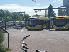
In two of the most recent posts, I talked about the types of people I saw biking as well as how land use changed as a result of building more biking infrastructure. For this post, I will briefly conclude my observations by discussing how I learned to put biking in a proper context as I feel we should with any debate about sustainable transportation systems: they must be truly multimodal for context and place, to be effectively sustainable. Without a doubt, a major lesson for me in these past four weeks is how multiple transport modes support and complement each other's utility. Walking and biking can help us go places within that sweet spot of four to six miles, which includes arriving at a bus or train station for when the journey is intercity or further out in a different region. As a result, the components for supporting those systems must be present: pathways, safe infrastructure, parking, and most importantly, destinations. The last bit is perhaps the most overlooked I feel th...

Biking and the Effect on Land Use

Image
Focusing on examples seen in both Utrecht and Amsterdam, another takeaway of this trip is the land use patterns I have witnessed visiting these cities. What drew my eye throughout exploring the different places is the availability of space that allows one to feel safe traveling via any mode. While our group notably saw fewer segregated spaces between modes in the Netherland examples compared to Denmark, that does not mean they did not exist. In the image below, an intersection in Amsterdam about a five-minute walk east of our hostel, one can see how crossings provide a lane for bikes and pedestrians to travel, keeping them separated from car, bus, or tram traffic. The islands between the crossings keep pedestrians safe when waiting for cross-traffic to clear the pathway but the islands also narrow the vehicle lanes, slowing traffic through the intersection and thereby enhancing safety. Presented in the picture are bicyclists crossing the road in the bike lane, with oncoming cars moving...

Exploring Amsterdam via the PUMA Game

Image
Arriving in our final city of the trip, Amsterdam, members of the group participated in the PUMA Game developed by Dr. Meredith Glaser of the Urban Cycling Institute housed in the University of Amsterdam. PUMA stands for Planning, Urban Design, Mobility, and Accessibility. The task challenged us to explore three areas of the city: the Post-War suburbs, the Pre-War region, and the city center (the war reference is for the period after World War II). We needed to identify and document a series of examples of how the spatial and social fabric of the city influenced these four elements of Amsterdam's transportation system. Riding the M53 Red Line from Weesperplein station to the southern terminus and suburb of Gaasperplas A station map of the M53 Red Line What I enjoyed about this activity is how I could compare different areas of Amsterdam that developed during different time periods in the last century as well as provide a comparison to the land use patterns employed in the United St...