Posts

Showing posts from July, 2022

Bicycle Transportation Supporting a Strong Towns Approach
Image
This final post for my blog will briefly talk about why I chose the topic of bicycle transportation and how it transforms urban landscapes and communities through a Strong Towns approach. I will also suggest why people in the United States should care about this topic. Simply put, I chose this topic for my final project because, in my four weeks in these two countries, there really was not one isolated thing I could direct my attention towards. I mean, there were plenty of options, but each topic drove outcomes or was an outcome, of another tangible element of the system. It is difficult to talk about the effectiveness of cycle tracks and enhanced safety without quickly pivoting to the reclamation of space, which then introduces discussions about increased development of housing, commercial businesses, public space, which then . . . the list just goes on like that. All of those topics could direct our attention to the city's financial health; the total number of amenities and asset...
We Need All Modes and More Choices

Image
In two of the most recent posts, I talked about the types of people I saw biking as well as how land use changed as a result of building more biking infrastructure. For this post, I will briefly conclude my observations by discussing how I learned to put biking in a proper context as I feel we should with any debate about sustainable transportation systems: they must be truly multimodal for context and place, to be effectively sustainable. Without a doubt, a major lesson for me in these past four weeks is how multiple transport modes support and complement each other's utility. Walking and biking can help us go places within that sweet spot of four to six miles, which includes arriving at a bus or train station for when the journey is intercity or further out in a different region. As a result, the components for supporting those systems must be present: pathways, safe infrastructure, parking, and most importantly, destinations. The last bit is perhaps the most overlooked I feel th...

Biking and the Effect on Land Use

Image
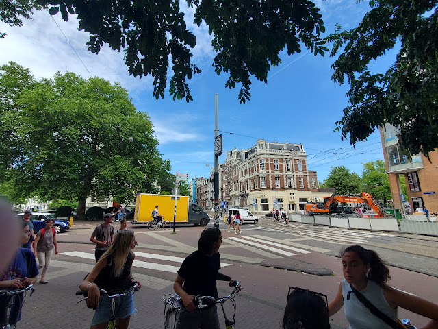
Focusing on examples seen in both Utrecht and Amsterdam, another takeaway of this trip is the land use patterns I have witnessed visiting these cities. What drew my eye throughout exploring the different places is the availability of space that allows one to feel safe traveling via any mode. While our group notably saw fewer segregated spaces between modes in the Netherland examples compared to Denmark, that does not mean they did not exist. In the image below, an intersection in Amsterdam about a five-minute walk east of our hostel, one can see how crossings provide a lane for bikes and pedestrians to travel, keeping them separated from car, bus, or tram traffic. The islands between the crossings keep pedestrians safe when waiting for cross-traffic to clear the pathway but the islands also narrow the vehicle lanes, slowing traffic through the intersection and thereby enhancing safety. Presented in the picture are bicyclists crossing the road in the bike lane, with oncoming cars moving...

Who is Biking?

Image
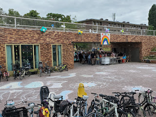
After experiencing Amsterdam for a couple of days, I wanted to briefly reflect on the types of people I see biking in each of these cities. The reason for posting about this topic is that the answer runs the spectrum of life stages, from very young children to older adults. In both Denmark and the Netherlands, I have witnessed young children, some probably as young as five or six, biking in the environment with their parents. Children not much older, closer to say an eight to 12 range also bike and often do so independent of any parents by their side. Biking in tandem with children are parents of varied ages and one can spot their presence by seeing the bikes with an extra passenger seat attached (see photo below of the Utrecht school for example). Several bikes parked at an elementary school in Utrecht, Netherlands; both bikes for adults & children   Adolescents, young adults, and middle-aged adults all bike frequently in both countries as one may expect to be the most common ...

Exploring Amsterdam via the PUMA Game

Image
Arriving in our final city of the trip, Amsterdam, members of the group participated in the PUMA Game developed by Dr. Meredith Glaser of the Urban Cycling Institute housed in the University of Amsterdam. PUMA stands for Planning, Urban Design, Mobility, and Accessibility. The task challenged us to explore three areas of the city: the Post-War suburbs, the Pre-War region, and the city center (the war reference is for the period after World War II). We needed to identify and document a series of examples of how the spatial and social fabric of the city influenced these four elements of Amsterdam's transportation system. Riding the M53 Red Line from Weesperplein station to the southern terminus and suburb of Gaasperplas A station map of the M53 Red Line What I enjoyed about this activity is how I could compare different areas of Amsterdam that developed during different time periods in the last century as well as provide a comparison to the land use patterns employed in the United St...

Impressions of Dutch Bicycling - Utrecht

Image
Arriving in the Netherlands' fourth most populous city, Utrecht provided me with perhaps the clearest comparison between Dutch and Danish bicycling approaches and cultures. Immediately, I noticed the difference between how space is utilized in support of bicycling in these two countries. Of course, there are cycle tracks in the Netherlands, but there are far more roads where bikes, cars, and pedestrians intermingle in an unchoreographed, but nevertheless orderly, system of transport. Pedestrians are not really supposed to be on the shared road space but my experience showed they will cross the road at will or step off a sidewalk into the road when the sidewalk is blocked off or choked down in space by the numerous parked bikes. The roads where cars and bicycles share space are called fietspad  or "cycle track, paths, roads". Here cars can travel on the same road but the law stipulates that bikes have priority within the traffic flow. Hence, I often biked alongside cars bu...

Mobility Hubs

Image
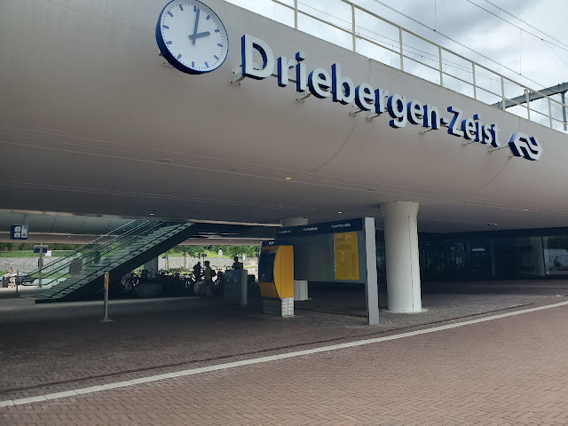
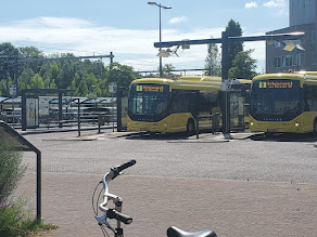
In an earlier post, I mentioned how in designing a complete sustainable transportation system, we must design to integrate various modes of sustainable transport rather than focusing solely on one effective mode. Today, we had an opportunity to learn more about how biking and transit work together in the Netherlands. Our instructor is an ex-pat from the United States, who first lived in Southern California, worked as a planner in Hawaii, and now lives in the Netherlands working for a public transit company. Bradley, our instructor for this afternoon, enlightened our group about how bicycle transport has integrated with the regional and inter-city rail services found in the country. Some of my classmates biked from Utrecht to our destination, the community of Zeist, just a bit east of Utrecht. I opted to train both ways to experience the rail service. Taking the Sprinter, which is the regional train between the cities nearby Utrecht, the train ride took only 11 minutes from our outbound...

Not So Different from Us

Image
This post responds to a prompt where I will write as if I am describing what I've seen in the Netherlands to a family member who is likely to reply that the Netherlands is far different from the United States and that what works here would not work in the U.S. Fun fact: did you know the Dutch also complain when anyone talks about taking a parking spot away? It's true! During the tour of the Dutch city Nijmegen, our guide, Sjors, mentioned that in creating much of the bicycling network we witnessed and biked along, pushback over parking existed and presented a barrier to the city council in supporting projects that would increase the bicycling infrastructure around the area. In describing one presentation about increasing bicycling infrastructure he gave to government officials, Sjors mentioned spending the first 10 to 15 minutes talking exclusively about cars. This aspect impressed upon me how many Dutch think about their cars and ease of driving, which is not so different comp...

Biking through a University Town (Odense)

Image
Our last stop in Denmark brought us to the country's third most populous city, Odense (estimated population in 2022 of approximately 172,500 residents). The population and size of the city provided an apt comparison to the city I've lived in the past two years, Eugene, Oregon. Not only are the populations comparable, but we learned that Odense is considered a "college town", supported by three universities: the School of Social Work under the umbrella of the University College, Little Belt network, Odense University, and the largest of the three, Southern Denmark University (SDU). The universities' presence is comparable to Eugene, which is home to Bushnell University, Lane Community College, New Hope Christian College, and the flagship institution, the University of Oregon. The task at hand then is to experience what it is like biking in a city that is predominantly younger, bolstered by the student population, but also one that is over 1,000 years old. I must ad...

Biking On Route 55 to Odense

Image
The journey from Korinth to Odense felt like a regional, long-distance commute, and for the first time, I experienced the potential of what regional bicycle transportation can provide between communities. As mentioned in a previous post about recreational cycling in Denmark, I began the journey from Korinth taking a recreational bike trail route labeled L1. End to end, the route took about 8 kilometers (approximately 5 miles), delivering me to the town of Ringe. From Ringe, I biked through the town on my way to Bike Route 55, which would take me all the way to Odense. Along my ride through Ringe, I recognized several of the traffic calming designs where pedestrians can cross the road and also deliver bicyclists through the intersection (see image below).   After taking a few back roads while traveling through Ringe, a narrow bicycle lane delivered me to Bike Route 55. The distance from Ringe to Odense is approximately 23 kilometers (a little over 14 miles). For the past three days,...