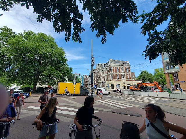
Exploring Amsterdam via the PUMA Game
Arriving in our final city of the trip, Amsterdam, members of the group participated in the PUMA Game developed by Dr. Meredith Glaser of the Urban Cycling Institute housed in the University of Amsterdam. PUMA stands for Planning, Urban Design, Mobility, and Accessibility. The task challenged us to explore three areas of the city: the Post-War suburbs, the Pre-War region, and the city center (the war reference is for the period after World War II). We needed to identify and document a series of examples of how the spatial and social fabric of the city influenced these four elements of Amsterdam's transportation system.
 |
| Riding the M53 Red Line from Weesperplein station to the southern terminus and suburb of Gaasperplas |
 |
| A station map of the M53 Red Line |
What I enjoyed about this activity is how I could compare different areas of Amsterdam that developed during different time periods in the last century as well as provide a comparison to the land use patterns employed in the United States, which inevitability impact how one moves about the built environment. For example, I noted how the transportation infrastructure functioned in several applications, providing traffic calming, freeing land to develop green space integrated with the paved roadways for both cars and bikes, and how building plots were smaller, providing the street with a greater number, and diversity, of businesses. That diversity injects not only a sense of an active community but also provides more destinations for people to acquire their basic necessities (food, medicine, childcare, healthcare, etc.) improving the accessibility of the neighborhood.
Along with two of my classmates, we started by traveling to the Post-War suburbs. Arriving at Gaasperplas (which is the name of a large park surrounded by the residential areas of Nellestein and the Gein as well as Waternet and the Gaasp), the elements of planning, urban design, and mobility immediately stood out within the construction of the Metro station. After descending the stairs and exiting the station, I saw bike parking spaces, and my classmates and I estimated the parking accommodated about 100 or so bikes (see picture below).
 |
| Bike parking available at Gaasperplas station abutted to a wide bicycle route that rings around the entire park |
In our efforts to participate in the PUMA game, we chose to ride to the end of a metro line to start our exploration, which inadvertently delivered us to a large park and green space rather than a residential area. Reflecting on this, one suggestion I have for future iterations of the game is to provide a list of the residential area names that could help direct participants' attention to where certain stations exist in relation to the communities. In hindsight, our group should have traveled the yellow line to the terminus station of Gein, one of the residential communities, to see more of the built environment's relationship with land use and how it impacts the transportation system. Nevertheless, we noted elements of mobility in the more residential areas around Gaasperplas. Several times, I saw individuals riding in assisted mobility scooters using the bike paths (as seen in the picture below).
 |
| Bike paths can improve mobility for individuals living with mobile disabilities |
I felt the PUMA Game provided an engaging format for taking in the effects of deliberate decisions that shaped the social and spatial spaces binding Amsterdam's urban and suburb fabric. If I could add one more suggestion, I must plug my love for light and subway rail systems to suggest bonus points for riding all five of Amsterdam's metro lines. Our group managed to ride four of them just in the course of navigating back to our closest station (we missed the orange line!). Easy and seamless transfers at most stations!


Comments
Post a Comment